
According to the National Hurricane Center’s tropical cyclone report, Hurricane Ike made landfall near Galveston, Texas, at 2:10 a.m. on Sept. 13, 2008. With sustained winds of 110 mph, it was classified as a Category 2 hurricane. Despite its relatively low category rating, Ike’s enormous size caused destruction typical of much more powerful storms.
The Path of Hurricane Ike on Its Way to Galveston
Ike started as a tropical disturbance that moved off the west coast of Africa at the end of August 2008. On the morning of Sept. 1, a tropical depression formed about 1,750 miles east of Puerto Rico. By later that afternoon, it had strengthened into a tropical storm and was named Ike.
As Ike moved west-northwest across the Atlantic, it intensified, reaching Category 4 strength on the Saffir-Simpson Hurricane Wind Scale. Ike traveled through Turks and Caicos, passed over Great Inagua in the Bahamas, and made two landfalls in Cuba before entering the Gulf.
As Ike barreled toward Galveston, it settled into the upper end of the Category 2 range with 110 mph sustained winds at landfall. The wind rating became one of the most important lessons of the storm, as it did not fully capture the amount of water Ike was pushing toward the coast.
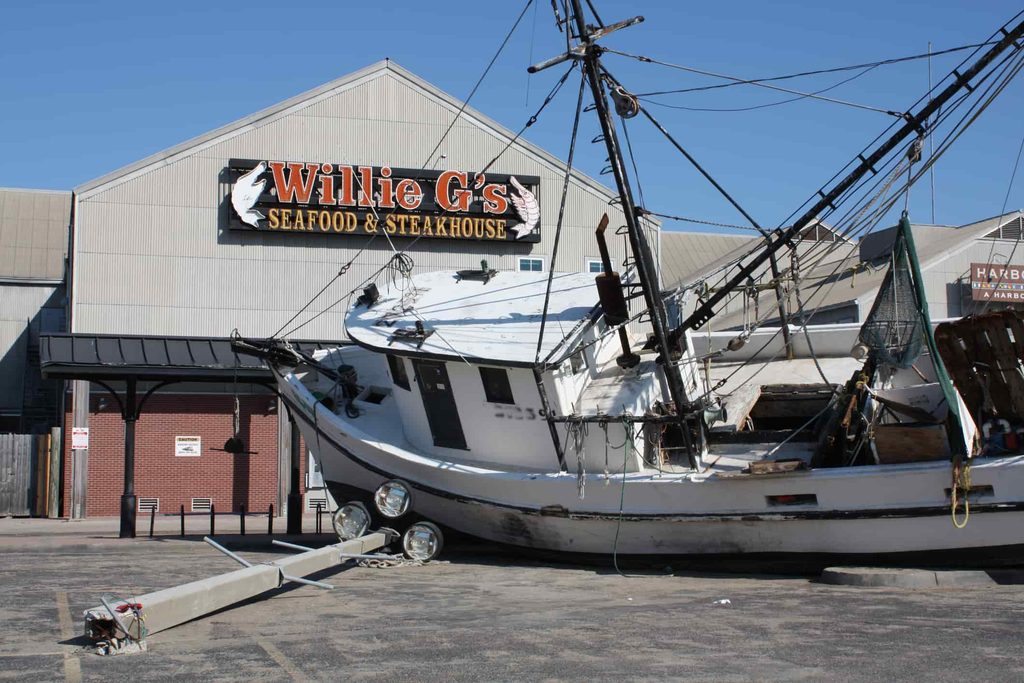
How a Category 2 Hurricane Caused So Much Destruction
The Saffir-Simpson scale measures sustained wind speed. It does not measure storm size, rainfall or storm surge. Hurricane Ike was enormous.
As it moved toward Texas, Ike’s tropical-storm-force winds stretched roughly 425 miles across, giving it a much larger reach than its Category 2 rating suggested. With its broad wind field, the storm pushed Gulf water toward the coast long before it reached Galveston.
That water became Ike’s most destructive force. The same National Hurricane Center report found that storm surge reached 15 to 20 feet along the Bolivar Peninsula and parts of Chambers County, high enough to sweep through homes, roads and entire low-lying communities. In Chambers County, the National Hurricane Center recorded a high-water mark of 17.5 feet about 10 miles inland, showing how far the surge moved beyond the shoreline.
Hurricane Ike’s Toll: Lives Lost and Economic Losses
Hurricane Ike caused $29.5 billion in damage and killed 103 people. NOAA’s National Weather Service reported 12 fatalities in Galveston and Chambers counties, where the worst storm surge occurred.
The storm also strained ports, shipping and energy systems across the region. In Galveston Bay and the Houston Ship Channel, damage and debris kept the ports of Galveston and Houston closed for several days after Ike. Nearly 150 tankers, cargo vessels and container ships waited offshore while crews worked to reopen the waterways.
Energy infrastructure took a hit, too. Citing the U.S. Department of Energy, the National Hurricane Center reported that Ike closed 14 oil refineries and two strategic petroleum reserve sites. Across Texas and Louisiana, the Department of Energy estimated that 2.6 million customers lost power.
For coastal residents returning after the storm, recovery began with basic questions of access, power and safe passage. Along the Bolivar Peninsula, Ike damaged key roadways, including State Highway 87 and the Rollover Pass Bridge in Gilchrist, which required significant repairs after the storm.
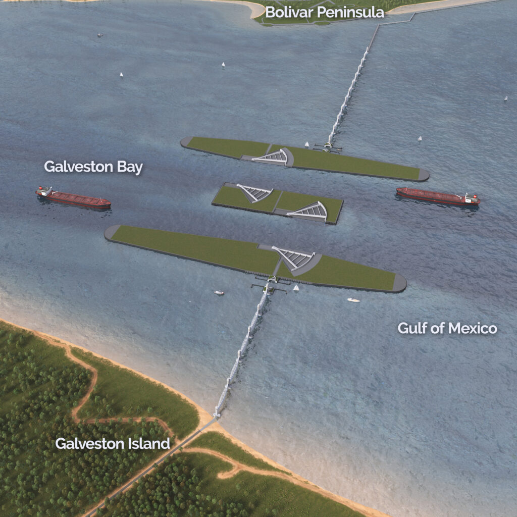
How Hurricane Ike Shaped the Coastal Texas Project
In the months after Ike, Dr. Bill Merrell of Texas A&M University at Galveston proposed a coastal barrier system for the Houston-Galveston region. The concept became known locally as “Ike Dike,” a name that tied the idea directly to the storm that exposed the region’s vulnerability to storm surge.
Over the next decade, the idea moved from local proposal to federal planning. The U.S. Army Corps of Engineers (USACE) completed a multiyear feasibility study for the Texas coast, examining storm risk reduction and ecosystem restoration at a scale commensurate with the region’s exposure.
The same need shaped our history. The Texas Legislature created the Gulf Coast Protection District (GCPD) in 2021 to serve as a non-federal sponsor for major coastal protection work along the upper Texas coast. In December 2022, Congress passed the Water Resources Development Act of 2022, authorizing the Coastal Texas Project for design and construction.
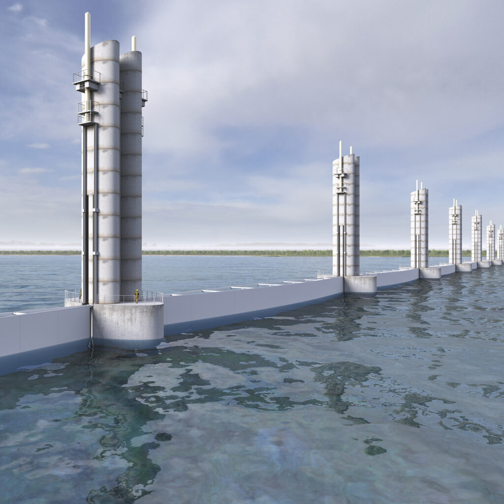
Today, two major elements of the Galveston Bay Barrier System, also known locally as “Ike Dike,” are in the engineering design phase. We work alongside USACE and the Texas General Land Office (GLO) to help advance funding, design coordination and long-term planning for this historic coastal protection effort.
A Hard Lesson for the Upper Texas Coast
Hurricane Ike showed why wind category alone cannot define coastal risk. A Category 2 storm pushed catastrophic surge into communities, damaged access routes, disrupted ports and energy infrastructure, and exposed how connected the upper Texas coast is to the safety and stability of the wider region.
That lesson continues to guide our work. Through the Coastal Texas Project, we are helping advance storm surge protection designed for the scale of this coast, the communities that call it home and the infrastructure that supports the region and the nation. Explore our History of Storms reportor contact us with questions about our work to safeguard this region before the next major storm.
