
The Gulf Coast Protection District is taking a new step toward understanding how the upper Texas coast changes from day to day. On Oct. 14, the GCPD Board of Directors authorized District staff to negotiate an agreement with Surfline Coastal Intelligence for a coastal camera monitoring project.
The project will test whether cameras paired with image-analysis software can give the District a clearer, more frequent picture of the shoreline than traditional methods provide. This initiative is part of the broader Coastal Texas Project and advancing the Beaches and Dunes feature.
A Coastline on the Move
The Texas coast is losing ground. According to the Texas General Land Office, the 367-mile Texas coast erodes at an average of 4.1 feet per year. About 64% of the coast is eroding at roughly 6 feet per year, and some locations lose more than 30 feet per year.
Even more alarming, the upper Texas coast is losing ground faster than the rest of the state. Researchers at the University of Texas Bureau of Economic Geology found shorelines east of the Colorado River retreating at about 5.3 feet per year, compared with about 3.3 feet per year on the central and lower coast. Their study flagged segments of Galveston Island and the marshy shoreline between High Island and Sabine Pass among the areas with significant long-term retreat.
Erosion is not only about losing sand. When beaches, dunes and wetlands shrink, the coast loses natural protection, and storms like Hurricane Ike do far more damage. Property values, tourism, and ports, roads and other infrastructure are all at risk.
Hurricanes: Years of Erosion in a Single Day
Most erosion happens slowly, a few feet at a time. Hurricanes are different. A single storm can reshape a beach in hours.
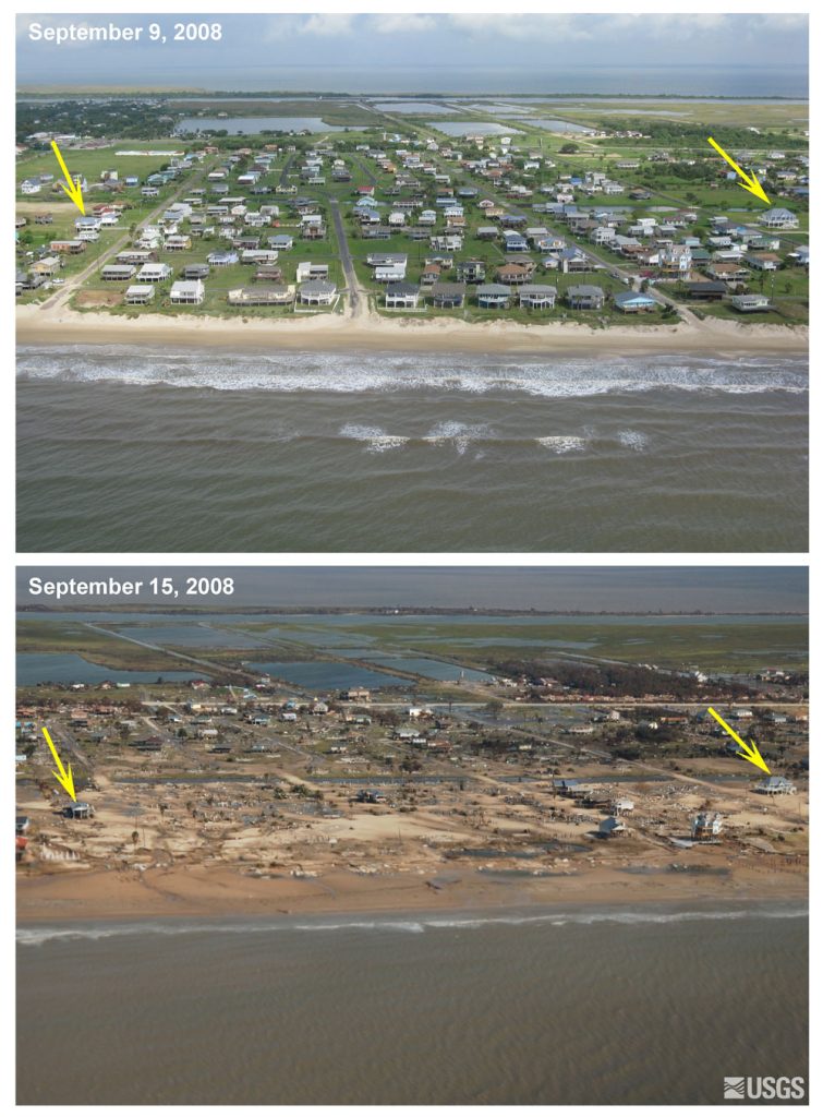
When Hurricane Ike made landfall on Sept. 13, 2008, its storm surge did the most extreme damage, and the Bolivar Peninsula took the brunt of it. Bureau of Economic Geology researchers found that Ike significantly changed the shape of beaches and dunes and moved the shoreline itself. They also noted that a coast can take two years or more to recover after a major storm.
Recent storms have kept up the pressure. A Texas A&M University at Galveston expert said tropical storms and hurricanes have very likely added to beach erosion, and that rising seas could make the problem worse over time. His prescription: “Nourishment remains our best weapon to fight erosion.”
Starting Small: One Camera, No Cost
The initial phase of GCPD’s coastal camera monitoring project will begin with one camera, provided at no cost to the District for 12 months. Over that year, District staff will evaluate how well the technology measures changes along the coast and whether the information is useful for the District’s work.
The District is not committed to anything beyond that first year. Any decision to add cameras would come back to the Board for separate approval. The camera will capture images of the beach and the surf. Software then analyzes those images automatically to measure natural conditions, including:
- where the shoreline is and how it shifts over time
- how wide the beach is
- wave height and activity
- how beaches change after storms
Today, this kind of information usually comes from periodic field surveys, when crews visit a beach to take measurements. Those surveys show conditions on the day they happen. A camera can collect information every day, building a continuous record of how the upper Texas coast changes through calm weather, seasonal shifts and storms.
“Our beaches are always changing, and the better we understand those changes, the better decisions we can make about protecting the coast,” said Rob Thomas, Chief Program Manager of the Gulf Coast Protection District. “This project lets us test whether daily camera data can give us a clearer, more affordable picture than we have today.”
Better information about how beaches erode and recover helps the District plan maintenance and use public resources wisely. Knowing where and how fast the shoreline is changing can help the District decide where attention is needed most, rather than relying only on occasional snapshots.
The data would also be shared with the District’s partners, the U.S. Army Corps of Engineers, the Texas General Land Office and Texas A&M University, to support coastal research.
One of the District’s long-term goals is to make data from the project available to the public, so residents can see how their coastline is changing.
Beaches and Dunes: A Line of Defense for the Upper Texas Coast
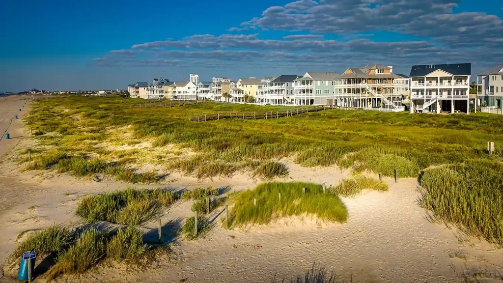
The Coastal Texas Project is a large-scale effort to reduce the risk of coastal storm damage and restore coastal ecosystems along the Texas coast. GCPD is the non-federal sponsor for its largest element, the Galveston Bay Barrier System, also known locally as the “Ike Dike.”
One of the Barrier System’s seven features is the Bolivar and West Galveston Beach and Dune System, known as Beaches and Dunes. It covers 43 miles of shoreline:
- 25 miles along Bolivar Peninsula
- 18 miles along Galveston Island west of the existing Seawall
The plan calls for a double-dune system built with approximately 40 million cubic yards of sand. It includes widening beaches with new sand, building and stabilizing dunes, and planting vegetation to reduce erosion and improve habitat. Working with The Gate (Bolivar Roads Gate System) and Galveston Seawall improvements, these beaches and dunes are designed to form a continuous line of defense that reduces the amount of storm surge entering the bay.
Beaches and Dunes is now in design, and engineering design will ultimately determine the final details. No construction start date has been set.
What Comes Next
District staff are now negotiating the final terms of the agreement with Surfline Coastal Intelligence. Once the agreement is in place, the District will select a location for the first camera. The District plans to share updates on this page as the project moves forward.
To learn more about the Gulf Coast Protection District and its work to protect homes, businesses, and infrastructure along the upper Texas coast, explore the rest of our website.
