
In Texas, hurricane season starts June 1 and runs through Nov. 30, following the Atlantic hurricane season. Peak activity is considered mid-August through mid-October. For the upper Texas Gulf Coast, that six-month window is a season of vigilance for individual households — but the region’s long-term readiness depends on something households can’t build on their own: storm surge protection at a regional scale.
Texas Hurricane Season: Key Dates and Facts
Hurricanes that threaten Texas draw energy from warm ocean water, especially as they move through or develop over the Gulf of America. During hurricane season, heat, moisture, low pressure and favorable wind patterns combine to organize tropical systems into storms strong enough to endanger coastal communities, infrastructure and lives. Though the dates are predictable, the storms are not.
When Does Hurricane Season Start and End?
The official hurricane season begins every year on June 1 and continues through the end of November. While tropical storms and hurricanes can form outside that window, it’s during these six months that conditions are primed for activity in the Caribbean, the Atlantic and the Gulf.
For coastal residents, it’s a season of vigilance. A storm that begins far from the Gulf may change direction, strengthen or shift its projected landfall as conditions change.
Peak Hurricane Activity: August Through October
The Atlantic hurricane season peaks around Sept. 10, with most activity occurring from mid-August through mid-October, according to the National Hurricane Center. Peak activity occurs later in the season, after the ocean has absorbed months of higher summer temperatures. By August and September, sea surface temperatures across much of the Atlantic, the Caribbean and the Gulf are high enough to support sustained tropical development. At the same time, wind patterns across the tropics often become more favorable, giving developing systems a better chance to organize rather than being torn apart by disruptive upper-level winds. Storms that make landfall in Texas come through the Gulf of America, where warm water late in the season provides ample heat and moisture for a system to maintain or increase its strength as it approaches the coast.
A 25-Year Record on the Upper Texas Coast
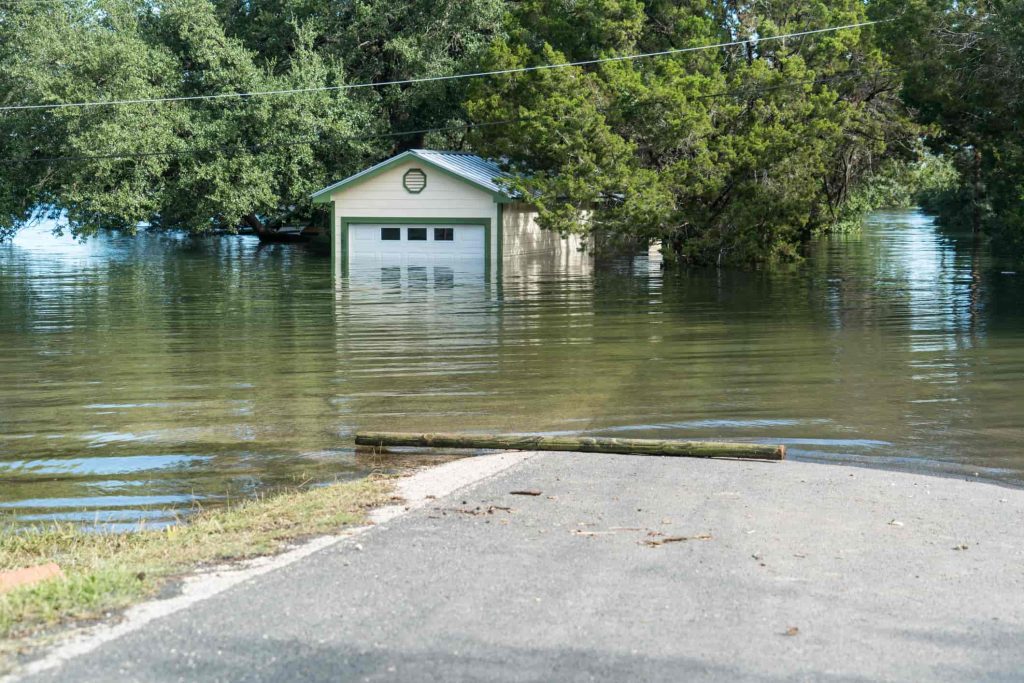
In the past 25 years, 13 storms have caused 589 deaths and $212 billion in economic losses across the region — among them Hurricane Rita (2005), Hurricane Ike (2008), Hurricane Harvey (2017), Hurricane Laura (2020) and Hurricane Beryl (2024). Each left a different lesson: Rita exposed the difficulty of a mass evacuation, Ike showed the destructive force of storm surge, and Harvey became a defining rainfall disaster. For the full breakdown of all 13 storms, see A History of Storms: The Last 25 Years.
What Makes the Texas Gulf Coast Especially Vulnerable to Hurricanes
The Texas Gulf Coast is shaped by low elevation, shallow bays and wide passages where rising Gulf water moves inland during a storm. Along that same coastline are neighborhoods, ports, refineries, roads, hospitals and public systems that millions of people depend on every day.
Geography: Low Elevation and Open Bay Access
Much of the Texas Gulf Coast sits within a low-elevation coastal zone, where flat terrain leaves little natural buffer against rising water. When hurricane winds push Gulf water inland, the surge can spread quickly across beaches, wetlands, roads and bayfront communities.
Open bay access adds to the danger. Natural passes, inlets and ship channels allow Gulf water to move into bays, creating a funnel effect that forces large volumes of water into shallower or narrower areas. Around Galveston Bay, the rising water has nowhere to go but inland. Hurricanes can also create compound flooding as heavy rainfall drains toward already-elevated bays and bayous.
Population and Infrastructure at Risk
The upper Texas coastline is one of the most populated and economically significant regions in the country. Harris County alone is home to roughly 5 million residents, and the Houston Ship Channel complex is the nation’s top port for waterborne cargo. Without serious storm surge protection in and around Galveston Bay, the entire region remains exposed to the full force of the next major storm.
How GCPD Is Preparing Our Coast for the Next Storm
Hurricane season returns every year, and the upper Texas coast needs protection built for that recurring threat. The Gulf Coast Protection District (GCPD) is the local non-federal sponsor helping advance major storm surge protection work for the region, in partnership with the U.S. Army Corps of Engineers (USACE) and the Texas General Land Office.
The Coastal Texas Project: What We Are Building
Our work is focused on long-term hurricane protection for the Texas coast. Through the Coastal Texas Project, we help advance funding strategy, design, regulatory coordination and regional planning for the largest coastal protection effort in U.S. history.
A central part of that work is the Galveston Bay Barrier System, also known locally as “Ike Dike.” This major project element is designed to protect communities, ports and critical infrastructure by reducing the hurricane-driven storm surge that can move from the Gulf into Galveston Bay.
Our mission is to protect our nation’s people, environment and economy from storm surge. To follow project milestones or contact us with questions about our work, visit our About Us page.
