
Coastal communities like those around Galveston Bay rely on more than one line of defense. Storm surge barriers, levees, dunes and dredging each play a distinct role in keeping floodwater out and helping shorelines hold their ground. Understanding these terms — what they mean and how they work together — helps residents, business owners and elected officials make sense of the engineering behind projects like the Coastal Texas Project and the Sabine Pass to Galveston Bay Project.
What Is a Storm Surge Barrier?
A storm surge barrier is a coastal flood protection system that helps keep storm-driven seawater from reaching communities, ports and critical infrastructure. These systems may use fixed defenses, moveable gates or a combination of both. In areas near major port hubs, a barrier must be able to remain open to accommodate vessels under normal conditions and close ahead of a major storm.
Passive Barriers vs. Moveable Gate Systems
Passive barriers are fixed defenses, such as levees, seawalls, dunes and raised floodwalls. They are always in place and provide continuous protection at the height and location where they are built.
Moveable gate systems add flexibility, allowing barriers to remain open under normal weather conditions to accommodate water circulation, vessel traffic and daily operations. When a surge threat develops, the gates can close to create a line of defense against rising water. Many large coastal systems use both approaches, because fixed and moveable features solve different parts of the same problem.
Notable Storm Surge Barriers Around the World
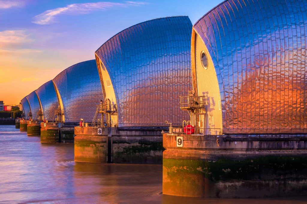
Large storm surge barriers protect coastal regions where population, infrastructure and economic activity are concentrated near vulnerable water. Two well-known examples are the Thames Barrier in London, which protects the city from North Sea surge moving up the River Thames, and the Maeslantkering in Rotterdam, which uses two enormous moveable gates to protect one of Europe’s busiest port regions while keeping the waterway open for daily shipping.
On the Texas Gulf Coast, the Galveston Bay Barrier System, also known locally as “Ike Dike,” applies this same principle at Bolivar Roads. For a full explanation of that project, including its seven features and The Gate, see What Is Ike Dike? The Galveston Bay Barrier System Explained.
What Is a Levee?
A levee is a raised wall of earth, concrete or steel built alongside a river, bay or coastline to hold back rising water. Unlike a moveable gate, a levee is a permanent, passive barrier — it doesn’t open or close, it simply stands between the water and what’s behind it. Levees are often paired with pump stations, which remove rainwater that collects on the protected side once the levee is in place.
In Orange County, Texas, for example, a new levee and floodwall system with multiple pump stations is planned as part of the Sabine Pass to Galveston Bay Project to address an area that currently has no large-scale storm surge protection.
What Are Dunes and Beach Nourishment?
Dunes are natural sand ridges that absorb and slow wave energy before it reaches inland areas. Beach nourishment is the process of adding sand to a beach to widen it and rebuild the dune system in front of it, often paired with vegetation planting to reduce erosion. Together, these features act as a natural, first line of defense that complements engineered structures like gates and levees.
The Galveston Bay Barrier System includes a dedicated beach and dune feature along Bolivar Peninsula and West Galveston Island. Learn more on the Galveston Bay Barrier System and Galveston Bay Shoreline and Island Protection project pages.
What Is Dredging?
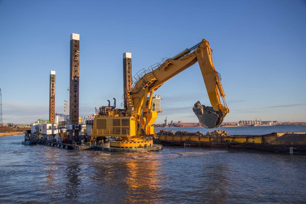
Dredging means removing sediment, sand or mud from the bottom of a waterway, typically to maintain the depth ships need to navigate safely — an ongoing need in a working waterway like the Houston Ship Channel. Dredging isn’t unique to storm surge protection, but it intersects with it: the material removed from a channel has to go somewhere, and where it goes matters.
Beneficial Use of Dredged Material
“Beneficial use of dredged material” refers to using sand and sediment dug up during dredging to rebuild marshland, wetlands and eroding shoreline, rather than disposing of it offshore. This approach turns a routine maintenance need into an opportunity to restore natural habitat along the coast.
What Are Jetties and Breakwaters?
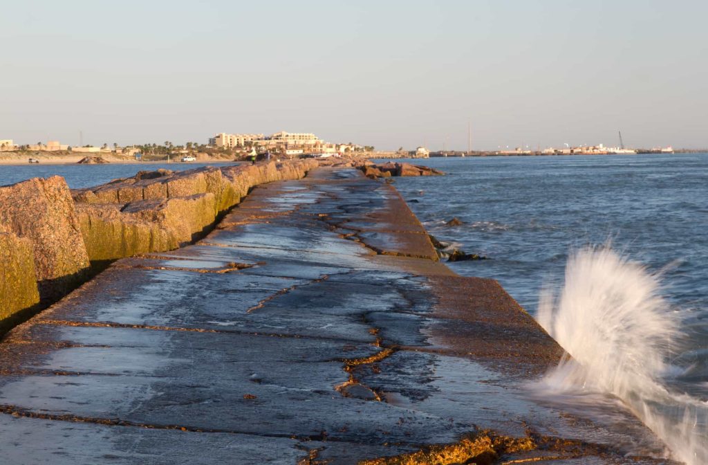
A jetty is a structure built out into the water, usually at an inlet or channel entrance, to stabilize the channel and limit the sand buildup that would otherwise require constant dredging. A breakwater is built roughly parallel to the shore, offshore or at a harbor entrance, to absorb wave energy before it reaches the beach or docks behind it. Both are common features of working ports and harbors along the Gulf Coast, distinct from the storm surge barriers and levees built specifically to hold back hurricane-driven surge.
How These Pieces Fit Together
No single structure protects a coastline on its own. Storm surge barriers, levees, dunes, dredging and shoreline features are designed to work as a system — engineered defenses paired with natural ones, each addressing a different part of the same risk. That’s the approach behind both the Coastal Texas Project and the Sabine Pass to Galveston Bay Project, which GCPD is advancing with the U.S. Army Corps of Engineers and the Texas General Land Office.
To learn more about how these pieces come together in our region, explore our project pages, read about our project partners, or contact us with questions.
